Home » Mexico Travel Info » Mexico Driving » Mexico Map
Mexico Map
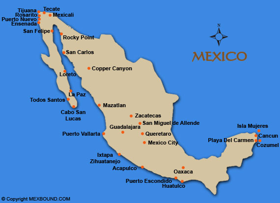
The Map of Mexico shows various cities in Mexico. Before you leave on your next adventure south of the border, be sure to purchase Mexican Insurance from mexbound.com. Remember, Mexbound.com is "the first choice for the smart traveler." Driving in Mexico can be challenging as large trucks and buses will pass in the opposite direction. Make sure you get gas, whenever you see a gas station as you may not see another open one for 100âs of miles. Avoid driving at night you may run into cows or other animals in the road, also it is rare but be careful of banditos, look for cars that are broken down on the highway these usually are traps, many tourists get robbed. If you see a car broken down dont feel bad for not stopping. The government pays a group of billigual mechanics called the Green Angels, that patrol the highways looking for people in need. If you are driving to Huatulco you will need a permit for your personal vehicle. Mexican Vehicle Permits can be obtained at Banjercito offices located along the border. You will also need a Mexican Tourist Visa if you plan on staying in Mexico over 72 hours. Mexican Visa permits can be obtained at Mexican Embassies and Consulates within the U.S. and Canada, or at the port of entry with Mexican Consulate Officials. Below is a list of cities offering maps and detailed driving instructions to them. Visit our Baja California map section for roads and driving maps in Baja. Click on the cities below for driving maps and directions to cities in Mexico.
Mexico Maps and Driving Directions
 The maps and directions provided in this section are opinionated general guidelines for driving in Mexico. We offer these Mexico maps and directions, to show possible driving routes to various cities in Mexico. Highways and road conditions are constantly changing, be sure to consult a Mexico road map for official driving routes in Mexico.